Which U.S. counties have lost the most tree canopy coverage?
To mark June as Great Outdoors Month, LawnStarter ranked Counties Going Bald: Tree Cover Loss Over 20 Years.
We compared over 3,100 U.S. counties based on the net percentage and net change in tree cover (in kilo hectares) between 2000 and 2020 using data from Global Forest Watch.
1 kilo hectare (kha) = 2,471 acres
Get lost in the woods of our ranking below. To learn how we ranked the counties, see our methodology.
Contents
- County Rankings
- Top 5 Close Up
- Key Insights
- Ask the Experts
- Methodology
- Final Thoughts: What’s Causing the Nation’s Canopies to Recede?
County Rankings
See how each county fared in our ranking:
Top 5 Close Up
Check out the slideshow below for a closer look at each of our 5 counties with the highest rates of tree cover loss between 2000 and 2020.
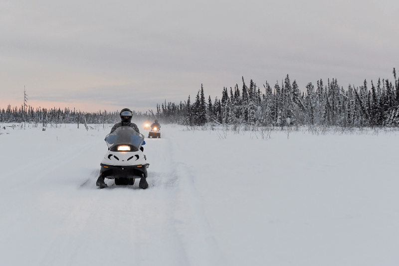
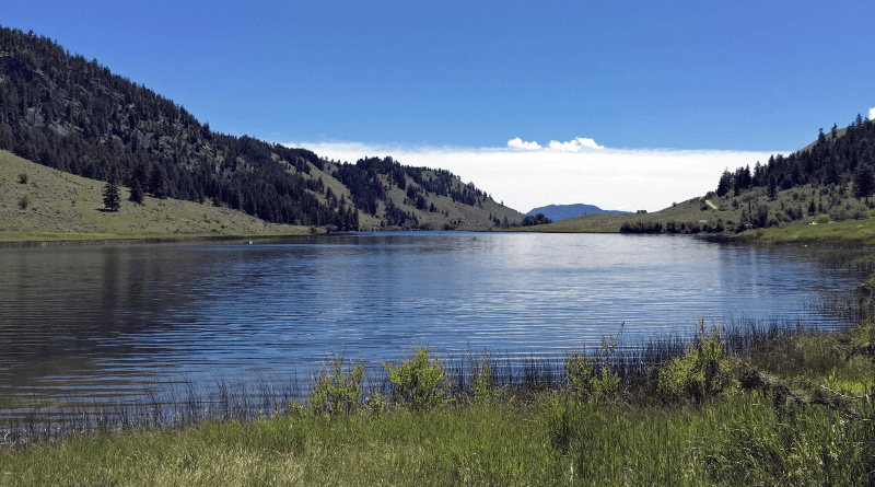
Net Percentage Change in Tree Cover (2000-2020): -10% | Rank: 142
Net Change in Tree Cover (2000-2020): -1,690 kilo hectares | Rank: 1
Photo Credit: Arctic Warrior / Flickr / Public Domain

Net Percentage Change in Tree Cover (2000-2020): -9.7% | Rank: 156
Net Change in Tree Cover (2000-2020): -128 kilo hectares | Rank: 2
Photo Credit: Leon Huang / Pexels / Pexels License
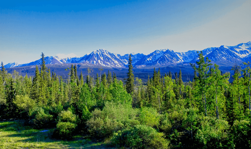
Net Percentage Change in Tree Cover (2000-2020): -4.3% | Rank: 415
Net Change in Tree Cover (2000-2020): -126 kilo hectares | Rank: 3
Photo Credit: Mike’s Alaska Travels / Flickr / CC BY-ND 2.0
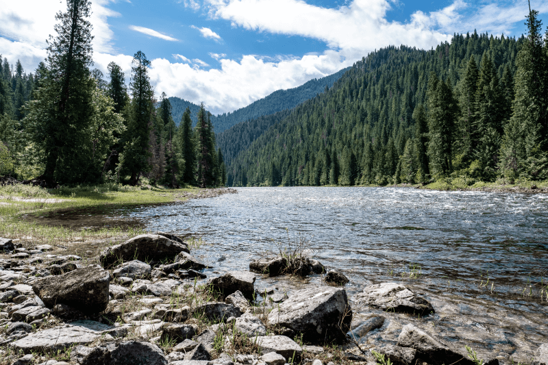
Net Percentage Change in Tree Cover (2000-2020): -6.7% | Rank: 255
Net Change in Tree Cover (2000-2020): -114 kilo hectares | Rank: 4
Photo Credit: Bob Travis / Adobe Stock / License
Net Percentage Change in Tree Cover (2000-2020): -12% | Rank: 113
Net Change in Tree Cover (2000-2020): -92.3 kilo hectares | Rank: 5
Photo Credit: Bureau of Land Management Oregon and Washington / Flickr / CC BY 2.0
Key Insights
700 counties in our ranking have lost 1 kilo hectare (or about 2,471 acres) of tree cover or more between 2000 and 2020. However, over half of the counties in our ranking — 1,794 of them — experienced a net gain in tree cover between 2000 and 2020.
Alaskan territories bookmarked the top and bottom of our ranking, with some of the largest recorded tree canopy losses and gains. 5 regions finished with high rates of canopy degradation, including Yukon-Koyukuk Census Area (No. 1) which is over 7X bigger than the largest county of the lower 48 states, San Bernardino County, California (No. 112).
- Millions of acres of Alaskan wildlands have been impacted by wildfires, and since 2016, 2 million acres of spruce forest area have been devastated by spruce beetle infestations.
5 Rhode Island, 12 Maine, and 23 Wyoming counties landed near the top with higher rates of tree loss.
- Tree mortality in Rhode Island can be attributed to gypsy moth caterpillars — which are responsible for killing over 45,000 acres of forest. Damage has also been caused by environmental stress, other pests, and diseases such as beech leaf disease, discovered in 2012. The state is working to “future-proof” some forested areas by planting more resilient species like southern pines.
- Many of Maine’s trees are succumbing to invasive threats such as emerald ash borers and hemlock woolly adelgids, which are degrading forests of native beech, ash, and hemlock trees. Coastal spruce trees are also under environmental threat from pests and harsh weather conditions.
- Estimates show that the mountain pine beetle epidemic impacted over 3.3 million acres of federal forest areas in Wyoming. The state is also removing many dying cottonwoods.
Arid counties with less tree cover to begin with have some of the most dramatic net percentage increases and decreases in tree cover. Several Texas counties sprouted along the bottom of our ranking near Lea County, New Mexico, in last place. These regions don’t naturally have heavily forested environments but have had comparatively large canopy gains.
Explore more regional insights below.
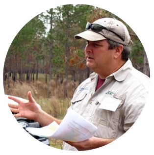
Ask The Experts
We turned to a panel of experts to learn more about what issues are stressing out tree canopies across the country. Read their insights below.
- What are 3 of the main driving factors of tree loss in the U.S.?
- Which U.S. tree species are most at risk from habitat loss or diseases?
- What are 3 of the worst consequences resulting from tree loss?
- What are 3 key steps to recovering from regional tree loss?
- What are 3 animals that are endangered due to tree loss?

What are three of the main driving factors of tree loss in the U.S.?
1. In Florida: Population growth (human). In 1900, we had around 500,000 people. By the time I was born in the late 60’s we had around 6 million, by the time I was an adult (18 years old) we had nearly doubled that, by 2000, about 16,000,000 million, and today over 23 million.
Roughly 1,000 people per day are moving to Florida and they all need places to live, work, shop, and recreate. These are enormous pressures on the land, and so we are seeing forest and agricultural lands being developed at unprecedented rates to accommodate this demand.
2. In Florida: Development.
3. In Florida: Hurricanes. In places that were devastated by Hurricane Michael, we saw massive loss of forest area. While some of those landowners salvaged and replanted their forests, there are still many that can not afford to do so.
Yes, trees will likely grow back on their own, but they will likely not be as productive as the previously managed forests. Also, some of the landowners are succumbing to the pressure of just selling the land off in most cases for direct development or speculative buyers who are looking to develop in the future.
What are three of the worst consequences resulting from tree loss?
1. Loss of ecosystem services: Water quantity (aquifer recharge), water quality (forest lands act as filtration systems), slow erosion, uptake nutrients, cooling effect of forests, carbon sequestration — the list goes on.
2. In urban areas, the cooling effect is very important — especially in Florida. We know that trees can reduce the impact of the urban heat island effect if canopy cover is sufficient. This has direct and indirect impacts on the health and well-being of the citizens living in these communities. They impact the economic well-being of communities as well — we have the research to back these statements.
3. Biodiversity, which is both relevant just for the innate importance of supporting habitat for multiple species, but, perhaps to bring it home, important for supporting human habitats. When the system is healthy and thriving, we (humans) do as well.
What are three key steps to recovering from regional tree loss?
1. Smarter development. We need to better understand the impacts of development and forest loss so that we can be more strategic in how and where we are developing across the landscape (large scale) and not just making decisions at a very local level where the broader context is not considered. Right hand talking to the left hand sort of thing.
2. Cities and counties need to engage in urban forest management planning which involves answering 4 questions.
- What do you have? They need an understanding of the forest and need an understanding of the values of the citizenry.
- What do you want? A clearly stated future condition of the forest and the services you want it to provide.
- How are you going to get there? An adaptive management plan, that states actions to support meeting goals and the expected results of those actions, for a 5–20 year horizon.
- How do you know if you are there (or getting there)? Plans must have a mechanism to monitor if the actions are achieving the desired outcome and provide a process to adjust based on the feedback received.
3. Education. We need the population and the leaders — city commissioners and county commissioners — to understand the value and importance of a healthy forest and urban forest for the welfare of those areas where we live. They need to understand WHY spending money to support these assets is not just a “nicety” to have if we can afford it but rather a “necessity” that one cannot afford to ignore.
Which U.S. tree species are most at risk from habitat loss or diseases?
Lots of diseases, insects, and invasive plants are impacting native trees and/or plants.
- Torreya tree: Very small range, very few left, and very much impacted by a disease (we may see these go extinct in the next decade or two).
- Laurel wilt (spread by a non-native beetle): taking out our red bays, swamp bays, sassafrass, and other species.
- Lethal bronzing (spread by leafhoppers) and our native cabbage palm (and many other palm species).
- Mangroves are being threatened by a new disease — the list is quite long, really.
What are three of the main driving factors of tree loss in the U.S.?
1. Climate change — drought and disease
2. Forest management practices and deforestation
3. Fire deficit.
What are three of the worst consequences resulting from tree loss?
1. Decrease in air quality
2. Increased urban heat island effect
3. Decrease of ecosystems and their services and loss of biodiversity.
What are three key steps to recovering from regional tree loss?
This is a difficult question, because climate change impacts many different species requirements and, once removed, it’s difficult to regain species back.
1. Although tree planting is a major foundation tool to help aid climate change, if not managed correctly it can be very costly and help very little in carbon sequestration, thus greatly a loss of biodiversity.
2. Design policies around the ecosystems that are affected or could be impacted, bring true scientists on board and educate via public grants to help plant trees in vastly unserved communities.
3. Educate cities in proper tree care and planting (another incentive) and low-intensity prescribed and natural fires.
What are three animals that are endangered due to tree loss?
1. Birds.
2. Insects.
3. Our native bees.
I would suggest looking at the listed threatened and endangered species list.
Which U.S. tree species are most at risk from habitat loss or diseases?
1. Pines, the higher the elevation.
2. Oaks.
3. Joshua trees — they are not actual trees, they belong to the genus Yucca.
Methodology
First, we determined the factors (metrics) that are most relevant to rank the Counties Going Bald: Tree Cover Loss Over 20 Years. We then assigned a weight to each factor based on its importance and grouped those factors into 1 category: Tree Loss. The categories, factors, and their weights are listed in the table below.
For each of the 3,132 U.S. counties with available data, we then gathered data on each factor from the sources listed below the table.
Finally, we calculated scores (out of 100 points) for each county to determine its rank in each factor, each category, and overall. A county’s Overall Score is the average of its scores across all factors and categories. The highest Overall Score ranked “Most Tree Loss” (No. 1) and the lowest “Least Tree Loss” (No. 200).
Note: Some location names (Census Area, Borough, or Municipality) are considered counties or their equivalents by the U.S. Census Bureau.
Sources: Global Forest Watch
Final Thoughts: What’s Causing the Nation’s Canopies to Recede?
United Nations members (and the U.S. by executive order) have committed to a 30X30 conservation goal, aiming to conserve 30% of their land and seas by 2030. Maryland has already met this goal.
Unfortunately, even conserved canopies can be decimated by problems like pests and diseases.
Tree cover loss can have many root causes.
- Extreme weather events can weaken or destroy trees: Tornadoes, hurricanes, flooding, ice storms, drought, derechos, landslides, and acid rain are known to damage or kill trees.
- A report found that wildfires were to blame for 26%–29% of total global forest loss from 2001 to 2019.
- Pests — especially invasive defoliating species like the spotted lanternfly and spongy moth — can weaken or kill native tree species.
- Trees can be impacted by various diseases — such as blight, oak wilt, annosus root rot, and other fungal diseases — which can be exacerbated by harsh weather conditions and pests.
- Across the globe 17,000 tree species are at risk due to human development. Forest fragmentation from road development, pipelines, and sprawl can also disrupt local ecology.
Deforestation leads to decreased biodiversity, impacting wildlife like lizards and birds, and the ecosystem overall. Habitat destruction can also increase disease transmission, such as rabies outbreaks.
Trees can sprout as climate heroes as we deal with unprecedented levels of carbon dioxide, with the ability to hold high amounts — over 48 pounds per mature tree — of CO2.
Conservation efforts like the Forest Legacy Program, sustainable forestry practices focusing on maintaining biodiversity, and widespread awareness about tree care and invasive threats can help keep our canopies green and growing.
Tree Care Tips
Trees are not only beneficial to the environment, but they can increase your property value and lower your energy bills. They also add some outdoor shade and an element of privacy.
Do your part and plant a tree. Keep it alive with the help of our guides below.
- Tips for Choosing a Tree at the Nursery
- How to Pick the Right Site to Plant a Tree
- How Much, How Often, and How Best to Water Your Trees
- How to Give Your Tree a Checkup
- 13 Signs Your Tree is Dying
- Common Types of Tree Fungus
- Best Disease-Resistant Trees
- 10 Best Drought-Tolerant Trees
Hire a local LawnStarter crew to help grow your backyard canopy or revamp your landscape with native plants and trees.
Media Resources
Quotes from LawnStarter Editor-in-Chief, Jeff Herman:
- Valdez-Cordova Borough, Alaska (No. 3,130), had the highest net gain in tree cover, 117 kilo hectares, followed by Alaskan territories Lake and Peninsula Borough (No. 3,129) and Matanuska-Susitna Borough (No. 3,125).
- Spacious counties like Idaho County, Idaho (No. 4), Aroostook County, Maine (No. 10), and Navajo County, Arizona (No. 11) — each among the nation’s 50 largest counties — scored near the top of our ranking with over 47 kilo hectares of canopy loss over 2 decades.
- 8 Idaho counties — like Idaho County (No. 4), Valley County (No. 6), and Custer County (No. 12) — scored among the 100 counties with the most tree cover loss. Canopies in the Gem State have been devastated by dwarf mistletoes, bark beetles, and other defoliators.
- Only 13 out of 58 California counties finished in the bottom half of our ranking. A statewide survey reported around 36.3 million dead trees in 2022. California forests struggle with drought, disease, and pests, in addition to warmer temperatures and overcrowded forests.
- Out of 11 California counties that exist entirely within the Sierra Nevada, 9 counties — such as Butte (No. 20), Madera (No. 139), and Placer (No. 197) — finished in the balding half of our ranking. Only Mono (No. 1764) and Kern (No. 2077) landed toward the bottom, with tree cover gains of 1.2 and 2.3 kilo hectares, respectively.
- Every year residents of Custer County, South Dakota (No. 33), set fire to an effigy of a mountain pine beetle at the Burning Beetle festival. The region has battled with this beetle on and off since the 1890s, and it is responsible for a 1996–2016 epidemic that damaged 450,000 acres of the Black Hills.
Main Photo Credit: Andrii Chagovets / Adobe Stock / License